The Bay Area has a “refinery corridor”, the five refineries spanning from Richmond to Concord. Keep in mind, there are only 135 refineries in the US, and FIVE of them are right here in our region.
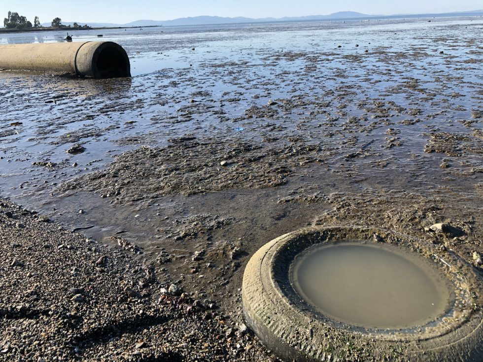
As outlined in our other blog, the health effects of living near, or even relatively far from a refinery are widespread, as is evident by these image above of our contaminated Bay taken just this past weekend (1/24/2021)
Find out how close you live to these refineries by using the maps below.
INTERACT WITH MAP 1: This story map titled “ Who Can’t Breathe” shows the disproportionate impacts of air pollution in the Bay Area, produced by Han Remis as part of their internship at Greeninfo Network. It explores the impact of pollution on the local communities with the help of easy to understand statistics and great visual presentation.
VIEW MAP 2: https://www.arcgis.com/home/webmap/viewer.html?webmap=e4f8660cab85457a9770e81b198bde75 A similar visualization to map 1, but which makes the exact locations of the refineries in the bay Area very clear.
SEARCH MAP 3: https://www.epa.gov/superfund/search-superfund-sites-where-you-live Search for Superfund Sites Where You Live. Superfunds are contaminated sites recognized by the EPA.